Meet the FABLE Colombia team
Leading the team is Javeriana University, recognized as a paragon of educational excellence within Colombia's rich academic landscape. The university embodies a dynamic research culture characterized by a multitude of specialized research centers and institutes.
Javeriana's influence extends beyond the academic sphere due to its strategic collaborations with several government bodies and non-governmental organizations. Such alliances empower the university to infuse policy discussions with research-backed insights. Their work facilitates the provision of evidence-based recommendations, shaping the course of policy reform with the goal of a more sustainable and climate-resilient future.
The team, a diverse assembly of experts, has defined a range of key research interest areas that encompass the complexity of environmental systems. They are keen on dissecting intricate systems through complex analysis, with a particular emphasis on land-use modeling. Their work delves into the profound effects of climate change and ways to mitigate them. They explore the process and benefits of forest restoration and seek to understand the fascinating world of environmental hydrodynamics.
Moreover, they are deeply involved in environmental flow modeling, aiming to understand the relationship between different elements in environmental systems. They are also actively engaged in the development of coupled models, wherein multiple models are integrated to provide more comprehensive and accurate representations of real-world systems. Through this breadth of research, Javeriana University's team is committed to making meaningful contributions in the quest for environmental sustainability and climate resilience.
Models used by the team: GLOBIOM, the FABLE Calculator, and GCAM.
Jorge Escobar
Javeriana University
John Chavarro
Javeriana University; Centro de Investigación en Ciencias y Recursos GeoAgroAmbientales (CENIGAA)

Andres Peña
Javeriana University
Ricardo Arguello
Independent

Wilfredo Marimón Bolivar
Javeriana University
Former member: Efraín Dominguez Calle.
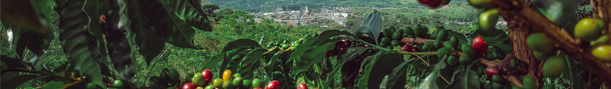
Transforming food and land-use systems in Colombia
Colombia is a “megadiverse” country with 59.7 million hectares (Mha) of natural forests covering 52% of its territory. The majority of these forests, around 66%, are located in the Amazon macrobasin, while another significant portion lies in the west, towards the Pacific Ocean. In 2020, agricultural lands covered 43.5 Mha, equivalent to 37.9% of Colombia's land surface, making it the second largest area after natural forests.
Most agricultural lands (33.7 Mha) were used as pasture for cattle pasture, while a smaller share (9.8 Mha) was used for permanent and annual crops such as coffee, palm oil, sugar cane, rice, potatoes, cassava, and corn. The main agricultural areas are located in the north (Caribbean region), northeast (The Plains or Los Llanos region), and in the inter-Andean valleys of the Magdalena and Cauca rivers. In 2010, Agriculture, Forestry, and Other Land Use (AFOLU) accounted for 66% of Colombia’s total emissions, primarily from grassland, followed by forest land and enteric fermentation. This is attributed to factors such as deforestation for land grabbing, illicit crops and extensive cattle ranching, and the degradation of natural forests due to selective and illegal logging.
Agriculture contributes 6.3% to Colombia’s GDP, and employs 16% of the labour force. However, the rural poverty rate reached 42% in 2020, with many landholdings lacking duly registered titles. Food security remains a challenge, particularly in rural areas with high poverty rates.
Levers for change include increasing agricultural productivity, especially livestock to potentially reduce land use for pastures, and promoting policies that incentivize agricultural productivity gains (i.e., increased access to technology, financing and secure land rights). Importantly, prioritizing the use of local scale and/or high spatial resolution instruments (i.e., multipurpose cadastral system) can help provide legal certainty on land ownership, identify priorities on technical assistance for smallholder farmers, and reduce incentives to deforest.
Key national objectives and targets
- Colombia's revised NDC includes an ambitious mitigation target of not emitting more than 169.4 MtCO2eq by 2030, equivalent to a 51% reduction in emissions from a revised 2030 reference scenario.
- Colombia has set a 2050 net zero GHG emissions target which has been enshrined in domestic law (Ley de Accion Climatica N°2169/2021, 2021).
- The country aims to restore 1 Mha by 2035 and gradually curb deforestation to less than 10,000 hectares per year by 2030.
Policy engagement
FABLE Colombia has fostered a highly successful collaborative partnership with Colombia's Ministry of Environment and Sustainable Development. Through a series of engaging meetings and workshops, they have effectively showcased the potential of integrated, long-term pathways for food and land-use systems in guiding informed decision-making for land use and the sustainable management of water resources. This collaboration resulted in the signing of a Memorandum of Understanding (MoU) aimed at actively supporting Colombia’s Law on Climate Action and its goal of "promoting prioritized actions in the Macro-basin Strategic Plans that contribute to the implementation of climate change adaptation and mitigation measures in each Macro-basin” by 2030.
The team has been actively engaging with the Rural Agricultural Planning Unit, which operates under the Ministry of Agriculture, to highlight the immense value of the FABLE Calculator in facilitating decision-making processes within rural land use planning. The team intends to maintain and further strengthen this collaboration, advocating for the adoption and utilization of integrated modeling tools and pathways to inform policymaking throughout Colombia. By doing so, they aim to make substantial contributions towards the realization of long-term goals for sustainable food and land use systems in the country.
Publications
- FABLE (2023). Ecological restoration and deforestation control: Implications for Colombia’s agriculture and climate goals. FABLE Policy Brief. Sustainable Development Solutions Network (SDSN) and International Institute for Applied Systems Analysis (IIASA). Paris/Laxenburg.
- FABLE (2020). Pathways to Sustainable Land-Use and Food Systems. 2020 Report of the FABLE Consortium. International Institute for Applied Systems Analysis (IIASA) and Sustainable Development Solutions Network (SDSN), Laxenburg and Paris. 10.22022/ESM/12-2020.16896. Colombia chapter.
- FABLE (2019). Pathways to Sustainable Land-Use and Food Systems. 2019 Report of the FABLE Consortium. Laxenburg and Paris: International Institute for Applied Systems Analysis (IIASA) and Sustainable Development Solutions Network (SDSN). Pathway for Colombia.
Recent activities